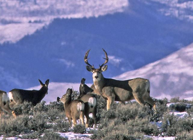
Mule deer

Geospatial Data

For a richer user experience, try our Esri-hosted "Open Data" site to acquire Wyoming Game & Fish authoritative geospatial data!

The Open Data site offers users the ability to review data set descriptions, preview data in tabular and map form, and save data in multiple formats. But if you need complete metadata content, this site does not currently package up all the metadata we include for some data and you should proceed to download data here at this website by following the links below.


Wyoming Game and Fish Open Data


Story maps provide a unique format for sharing maps, photos and narratives to "tell a story" in a single electronic document.  This engaging format is also an Esri product, in which we have customized and configured the contents of a template made available by Esri.


Wyoming Game & Fish geospatial data available on this site has the following general characteristics:

Format Esri Shapefile (with a couple of exceptions in file-GDB format to preserve long attribute headings and/or grouped content)
Compression Utility Microsoft default - Compressed (zipped) folder
Projection WyLAM (Wyoming Lambert Conformal Conic)
Datum NAD83 (North American 1983; Spheroid GRS 1980)
Extent Statewide, or the full extent of the theme if less than statewide
Metadata Content We maintain a standard for metadata content, and this is a prerequisite to the automatic distribution of our geospatial data

Disclaimer

Game and Fish geospatial data files are not represented as legal documents and are not intended to be used as such. The information contained in these data is dynamic and may change over time. Locational accuracy reflects resource-level use; no professional-grade surveys were conducted to either support or improve inherent accuracies. It is the responsibility of the data user to use the data appropriately and consistent within the limitations of geospatial data in general and these data in particular as outlined in each data set's accompanying metadata.

Contact

Troy Gerhardt, GIS Analyst
troy.gerhardt@wyo.gov | (307) 777-4605


For sage grouse GIS data:
Contact Garrett Catlin at (307) 777-4567 or garrett.catlin2@wyo.gov

Please note:  Data layers with boundaries related to public access (specifically Hunter Management Area Boundaries, Walk-In Hunting Boundaries and Walk-In Fishing Boundaries) can change at any time, even within a hunting season.  Do not rely solely upon the information in these layers, but rather also consult the online mapping applications as these are kept current.


Access Yes Administrative Regions
Commission Districts
Fish Administrative Regions
Wildlife Administrative Regions
Wildlife Biologist Districts
Game Warden Districts
Terrestrial Habitat Biologist Districts
Habitat and Access Branch Administrative Regions
Public Access Areas
Wildlife Habitat Management Areas
Hunter Management Area Boundaries
Antler Regulation Area
Walk-In Hunting Boundaries
Walk-In Fishing Boundaries

Hunt Areas and Herd Units: Herd unit boundaries are rarely requested, but are available below. Alternatively, they can also be derived from the associated hunt area layers simply by dissolving on the herd unit attribute to create those layers. Herd units are typically a collection of smaller hunt areas.

Seasonal Ranges vs. Crucial Ranges: Crucial ranges have been extracted from seasonal range layers and saved as unique GIS shapefiles. You may download the seasonal ranges and select out the crucial range types (or any range types you prefer) yourself. If you only desire crucial ranges, this has been completed for you.

Parturition Areas: These areas represent lambing, fawning and calving areas. 

*The heading of "Migration Corridor Complexes (all big game)" provides corridor data approved for use as per the Commission's Migration Corridor Policy.


Migration Corridor Complexes (all big game)  
 Mule Deer - Sublette
Mule Deer - Platte Valley
Mule Deer - Baggs
 
Antelope  
Hunt Areas
Herd Units
 Seasonal Ranges
Crucial Ranges
Parturition Areas
Bighorn Sheep  
Hunt Areas [Updated]
Herd Units
Core Native Herds
 Seasonal Ranges
Crucial Ranges
Parturition Areas
Bison  
Hunt Areas
Herd Units
  
Elk  
Hunt Areas
Herd Units
Feed Ground Locations
 
Seasonal Ranges
Crucial Ranges
Parturition Areas
Moose  
Hunt Areas [Updated]
Herd Units
 Seasonal Ranges
Crucial Ranges
Parturition Areas
Mule Deer  
Hunt Areas
Herd Units
Deer Nonresident Regions
 Seasonal Ranges
Crucial Ranges
Parturition Areas
Rocky Mountain Goat  
Hunt Areas
Herd Units
 Seasonal Ranges
Crucial Ranges
Parturition Areas
White-tailed Deer  
Herd Units
 
Seasonal Ranges
Crucial Ranges